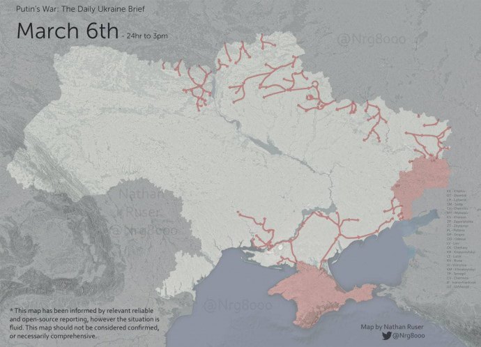
The Center for Countering Disinformation at the National Security and Defense Council provided an up-to-date map indicating the roads and areas temporarily under the control by enemy troops as of March 6. The data was published in the CCD telegram channel.
The Center for Counteracting Disinformation again stressed that the occupiers do not control any of the territories – they only temporarily took control of certain roads and localities.

"The map was presented by Nathan Roser of ASPI International Cyber Policy Center (an expert who analyzes satellite data and open data at the Australian Strategic Policy Institute, – editor). It displays the most up-to-date and accurate information without manipulation regarding the territory," the Center said.
As a reminder, 11th day of the ongoing war with Russia. Ukrainian cities are bravely defending themselves. According to President Volodymyr Zelenskyy, Russia announced the shelling of Ukrainian defense-complex enterprises on March 7.


